I can’t think of a more relevant phrase when describing the Road to Hana than the cliché “it’s not the destination but the journey that matters”. The town of Hana, at the end of the road, is a tiny little town that we didn’t even stop off at, however the 67.5 km (42 miles) coastal road that leads to it, is classified as one of the best drives in Hawaii (and I couldn’t agree more). Made up of more than 56 one-lane bridges and 617 hairpin curves, there are so many places to stop off along the way for amazing photo opportunities, hikes, swimming and food, that this relatively short distance is turned into an all day adventure.
As we were doing the drive we saw lots of people stopping off at different locations and wondered how they knew where to go. It wasn’t until afterwards when we were filling up our car at a Shell Petrol station that I saw a CD with a narration guide for driving the Hana Hwy! If you don’t want to buy the CD, here are some of the more popular stop-off spots.

At the intersection of Hwy 36 and Hwy 365 the Hana Hwy changes numbers to Hwy 360 and the markers on the road begin again at zero (this will help finding the points of interests along the road).
2 mile marker: on the right hand side is the start of the walk to Twin Falls a 25 min round trip to the waterfalls and back.
3.5 miles: Door of Faith road leads down to the historic Kaulanapueo Church which was built in 1853.
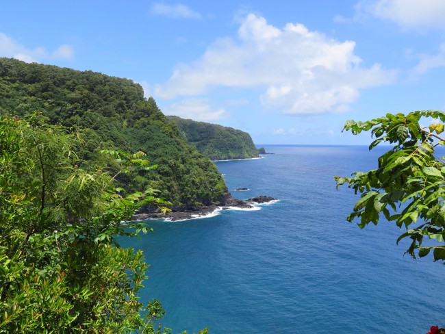
9.5 miles: Waikamoi Nature Trail is a 30 min loop walk through the forest which gives you a good view of Hana Hwy from the ridge at the top.
10 mile marker (just before): Waikamoi Falls and a pool are just by the side of the road at the bridge.
11 mile marker: Puohokamoa Falls can be seen from the bridge on the road.
11.5 miles: Haipuaena Falls can be reached by walking up stream for a couple of minutes and also has a pool that you can swim in.
12 mile marker: Kaumahina State Wayside Park has picnic tables and toilets.
14 mile marker: a road leads down to Honomanu bay, a rocky black-sand beach that you can snorkel at if the water is uncharacteristically calm.
17 mile marker: (half-way along the Hana Hwy) is a road that leads to the small quiet village of Ke’anae which has a church made of lava rocks (built in 1860) and a seabird sanctuary on Mokumana Island. Just past the 17 mile marker is a path leading to the Ke’anae Peninsular Lookout.
18.25 miles: Wailua Rd leads down to Our Lady of Fatima Shrine and also gives you a view of Waikani Falls if you look back up towards the Hwy.
19 mile marker: Wailua Valley State Wayside lookout is on the right hand side.
22.5 miles: Pua’a Ka’a State Wayside Park where there is a waterfall, pool for swimming, picnic tables and toilets.
27.5 miles: Coconut Glen’s which makes the most (possibly only) delicious vegan ice-cream I have ever eaten!
32 mile marker: Wai’anapanapa State Park where there is a black-sand beach, two lave tube caves and a trail along the coast leading to Kainalimu Bay that goes past lava fields, blowholes and temple ruins.